It is a bold idea, some say, to plan a trail system linking neighborhoods to each other and local parks in a township that has very little green space left.
This item is available in full to subscribers.
We have recently launched a new and improved website. To continue reading, you will need to either log into your subscriber account, or purchase a new subscription.
If you are a digital subscriber with an active subscription, then you already have an account here. Just reset your password if you've not yet logged in to your account on this new site.
If you are a current print subscriber, you can set up a free website account by clicking here.
Otherwise, click here to view your options for subscribing.
Please log in to continue |
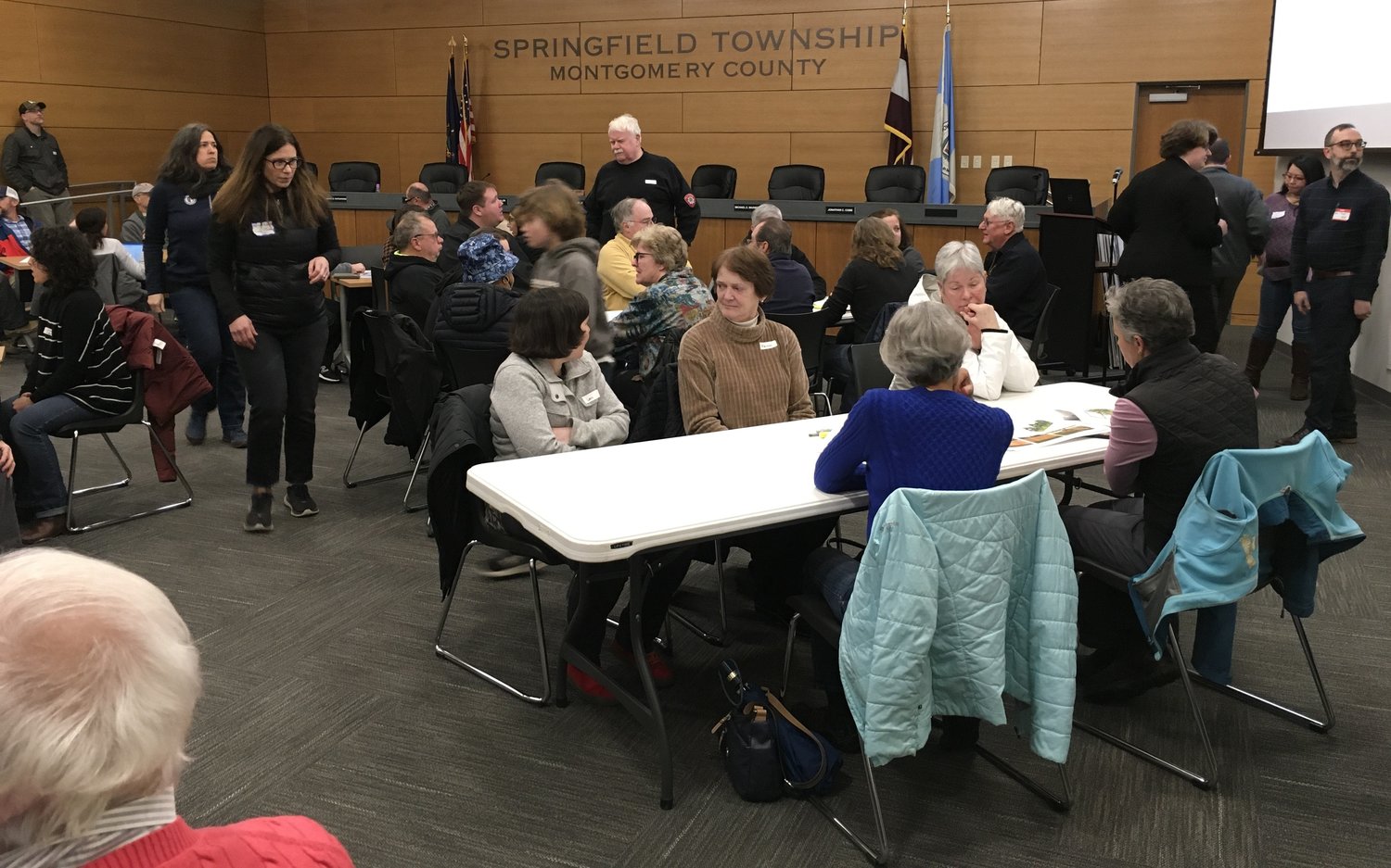
It is a bold idea, some say, to plan a trail system linking neighborhoods to each other and local parks in a township that has very little green space left. However, many Springfield Township residents say they want more trails and believe they can make it work.
More than 65 township residents attended the Township's second public meeting on March 13, with the first public meeting held in September 2022, to provide feedback on the current draft of the Master Trail Plan.
Master Trail Plan Task Force members who attended the meeting included Commissioners Jonathon Cobb and Susanna Ratsavong; Assistant Township Manager Brandon Ford; Neil DiFranco, a member of the Springfield Township School Board; Patrick Hynes, of the Environmental Advisory Committee; Gerald Quill, of the Planning Commission; Melissa Brookes, of the Friends of Cresheim Trail, and Montgomery County planners Anne Nygard and Brian Olszak were on hand to explain the plan and answer questions. Board President Jim Lee and Commissioner Peter Wilson also attended the meeting.
After a brief presentation, neighbors spent around nearly two hours meeting in small groups around tables placed throughout the room, with each table featuring a large, detailed trail map and a dedicated volunteer who recorded neighbors' comments, suggestions, and questions about the plan.
Most residents who participated expressed enthusiasm about the plan. A teacher in the Springfield Township School District said that he was looking forward to walking or running from Oreland, where he lives, to other parts of the township. A woman living in the Falcon Hill Estates area was curious about how it might work for her neighborhood.
A Wyndmoor resident was intrigued by the idea of making some streets into "Neighborhood Greenways," also known as "Bicycle Boulevards." The Greenways use pavement markings to delineate walking and cycling lanes, wayfinding signage, traffic calming techniques like speed humps, raised crosswalks, raised intersections, curb extensions, and medians, and other methods like traffic circles to make low-volume streets safer and more accessible to pedestrians and cyclists. The trail plan presented at the March public meeting showed Neighborhood Greenways in Oreland (Lorraine Avenue), Erdenheim (Preston Road), and Wyndmoor (Patton Road, Ardmore Avenue, and East Lane).
But there were certain neighbors, Flourtown Gardens residents in particular, who opposed a proposed trail running along their backyards.
One resident was very concerned about someone being able to look into her child's room, which is located in the back of the house facing the backyard. Another Flourtown Garden resident said that he was not concerned about property values as much as he was about safety. He wondered whether the trails could be closed at night and whether the police would regularly monitor the trails. Olszak explained that planting trees and putting in fences along the trail could maintain privacy. He emphasized that trail safety is paramount and that he heard their concerns.
When asked if there were any success stories in resolving the concerns of those opposed to a trail running so close to their houses, one table's volunteer reporter, Ellen Miramontes, a Montgomery County planner, talked about the 2.4-mile Radnor Multipurpose Trail (also known as the P&W trail) that opened in 2006. Residential property owners initially opposed the Radnor trail due to safety and vandalism concerns. However, most Radnor residents say they are now happy with the trail due to its positive impact on the community and significant added value to residential properties.
According to the Task Force's Trail Usage Survey results, Springfield Township residents prefer to walk to the trails they want to use rather than drive to them. However, the township faces challenges in creating a trail system. Oreland and Wyndmoor residents, for instance, cannot safely walk to other neighborhoods right now. Another key challenge is that Bethlehem Pike and Cheltenham Avenue present significant walking barriers to adults and students. PennDOT has already begun to reduce the number of lanes on Bethlehem Pike and could consider doing the same on Cheltenham Avenue.
Brandon Ford, the assistant township manager, was pleased with the amount of constructive feedback from the March public meeting. The Task Force's next step is for the planners to revise the proposed trail networks based on the feedback from the public meeting. Ford expects that the Task Force will be able to present a new draft at a commissioners' meeting in the summer.


